|


|
 |
|
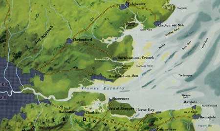 |
Essex, a county in the east of England, bounded by Suffolk, Cambridge, Hertfordshire and Middlesex; and separated from Kent by the Thames estuary. It is about 54 miles long and 48 broad and is divided into 18 hundreds. It is fairly flat, yet sufficiently varied not to be monotonous; but, excepting at a few points, the coast is flat and marshy. |
|
|
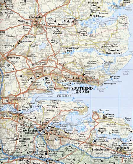
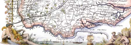
Below is an extract from Thomas Moule's 1830's County Map of Essex, and alongside is a modern map detailing the area that the Vandervord family mainly lived during the 17th, 18th and19th centuries - from Southend-on-Sea to Canvey Island. |
|
|
|
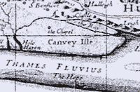
The oldest British reference for the Vandervord
family name found so far, is in the marriage records of Canvey
Island Chapel
|
|